Days 64-66: The Guillotine and Buena Vista
Day 64: Cornelius Creek Shelter to Johns Hollow Shelter — 21.6 miles
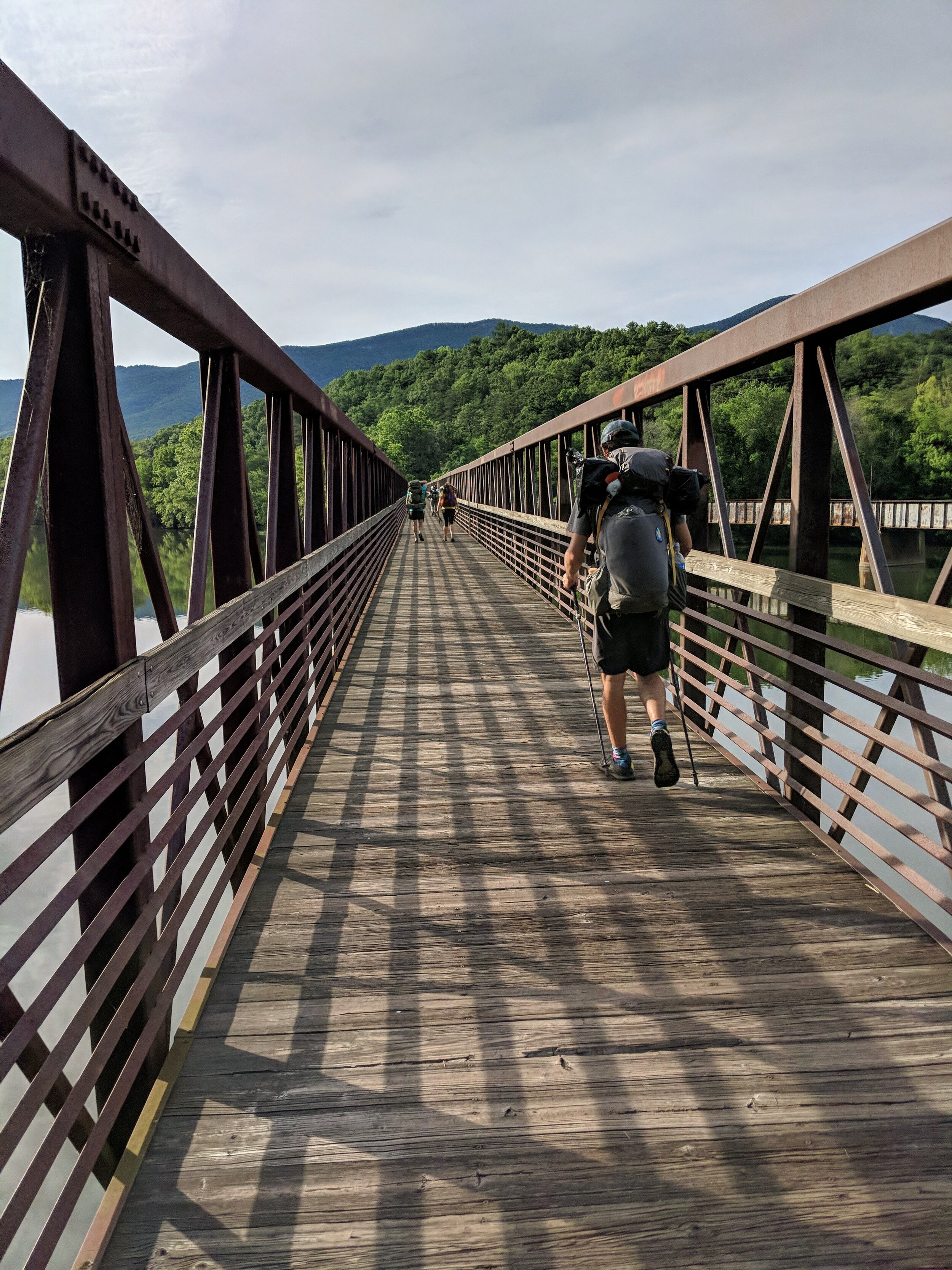
On June 15th, we hike over 21 miles, a distance I covered in two days on my section hike in 2016. I remember that hike, how I had gone swimming with a thru-hiker named Chipotle in the James River beneath the longest footbridge on trail. As soon as we climbed back up onto the rocks to dry out in the sun, we spotted two different snakes swimming in the same area.
Today, we pose for pictures at the Guillotine, where a huge boulder is wedged between the rocks, poised to drop onto the hikers below. Etienne and Rob both climb up to stand on top of it, suggesting it’s not as precarious as it appears.
The trail is scenic as we approach the James River this time, but I recount my story of the cottonmouths and we pass on the swimming. The water doesn’t look too appealing anyway, murky and green-brown. Instead we cruise along a road, then along a stream, and reach the shelter at the foot of a steep climb.
Day 65: Johns Hollow Shelter to Long Mountain Wayside / Buena Vista – 20.1 miles
This is the first time I’m going to do two consecutive days of 20 miles or more, and the day begins with the slope up to Rocky Row and Saddle Gap. The views are good, and I’m listening to the end of the Dresden Files audiobook.
At the top of Bluff Mountain, I pause the audio and remove my headphones as we approach the Ottie Cline memorial. In November of 1891, 4-year-old Ottie Cline went outside with his classmates to gather kindling for the wood-stove that heated their one-room schoolhouse and never returned. The entire town searched for the little boy, the local reverend’s son, but he could not be found. Winter passed, and four months later, his remains were discovered by hunters at the peak of Bluff Mountain, and Ottie remains the youngest child ever to make the steep 7-mile hike to the mountaintop alone, where he died of exposure overnight.
The story leaves me feeling melancholy for the small boy who lost his life here 127 years ago. I wish I could pick some flowers to leave on the marker, LNT-principles or no, but a rattlesnake has taken up residence in the cracked concrete below the memorial, and the glimpse of the snake’s flicking tongue persuades me to leave the small monument alone.
We continue along the ridge, crossing the Blue Ridge Parkway, where someone has left a cooler full of gallon jugs of sweet tea. I pass on the tea but grab a handful of ice from the cooler and drop it into my water bottle, and the cold water is a refreshing (if possibly unsanitary) treat.
Toward the end of the day, I am getting tired, but the last stretch of trail is smooth and we hike fast. When we reach the road, Ashley looks at her watch. “Wow, guys. Four point three miles in less than an hour and a half.” I grin. On a treadmill or a flat city street, 3.5 miles an hour is a comfortable walking pace for me, but on the AT with a pack, to average 3mph for more than four miles-- especially the last four miles of 43 miles in two days-- feels like winning a race.
We attempt to hitchhike into Buena Vista, as recommended in our AWOL guide. But the traffic on the Blueridge Parkway is scarce, and the cars that do pass don’t stop. Dusk is approaching, and once it gets dark, we know our chances of someone picking us up will be dismal. As we start to debate our options, a Jeep pulls aside. It’s a father and son, but they can only take one of us because they also have a car seat for a younger sibling in the back seat. We make a hasty, misguided decision and I hop in, but once I’m in town by myself, I realize the mistake. I have accidentally abandoned a trio of foreigners on the top of the mountain, and none of them have U.S. cell service to contact me about whether they’ve found a hitch. As the sun sets, I call a few cab companies listed in my guidebook to try to find them a ride into town. One is out of business, and another won’t pick up a client on the Parkway. The third company tells me they already have a driver en route to the trailhead, so if there’s room, my friends will be welcome to split the fare.
Sure enough, a cab soon arrives packed with thru-hikers: Etienne, Rob, and Ash were able to split the fare when another American thru-hiker arrived at the trailhead and managed to call the cab service. I’m relieved to be reunited with my little tramily, and we stuff ourselves with an enormous Sicilian pizza.
There’s a large park and campground in Buena Vista where thru-hikers are welcome to camp and shower for a small fee. It just so happens that this weekend, an enormous Fiddler’s Convention is in town, so we expect a crowd. The owner of the pizzeria is kind enough to drive us to the venue, but she mistakenly drives us past the entrance where the thru-hiker area is located. Instead, she drives us over a mile up the mountain to the car camping area. We don’t realize we’re in the wrong place until we search for a site to pitch our tents and only find crushed gravel pads designed for RVs, not tent stakes. Our ride has disappeared, so by the light of our headlamps, we start down a trail through the woods (with a helpful sign that simply reads “Trail.”). This path is littered with blowdowns. I’m exhausted from the aggressive mileage of last two days, and climbing over these trees with my pack on feels like a Herculean task. Eventually, the trail is completely unmaintained and impossible to follow, so we bushwhack our way downward, following the sound of fiddle music.
After what feels like hours (but was probably less than 30 minutes), we emerge in the clearcut swath of hillside beneath some powerlines, and we wade through the tall grass down to the main part of the campground. It’s crowded with camper vans and tents down here, and we still don’t see the other thru-hikers, but we find an unoccupied patch of lawn and pitch our tents. The unexpected extra mile of headlamp bushwhacking has left me practically weeping from exhaustion. Despite the music blaring from speakers across a baseball field, I fall instantly asleep.
Day 66: Buena Vista – Hog Camp Gap — 6.3 miles
We procrastinate all morning, eat at a barbecue place for lunch while our laundry dries at the laundromat, go to the Dollar Store and Hardees and Burger King in search of wifi, and eventually manage to hitch a ride back up to the trail. We all agree that despite what AWOL says, the Buena Vista was not the most hiker-friendly trail town, and if we’d had the chance to do it over, we’d have resupplied the day before in Glasgow instead.
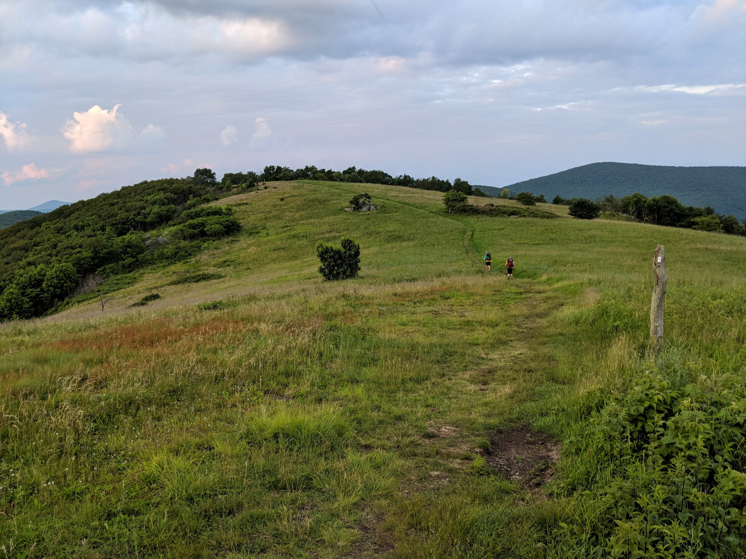
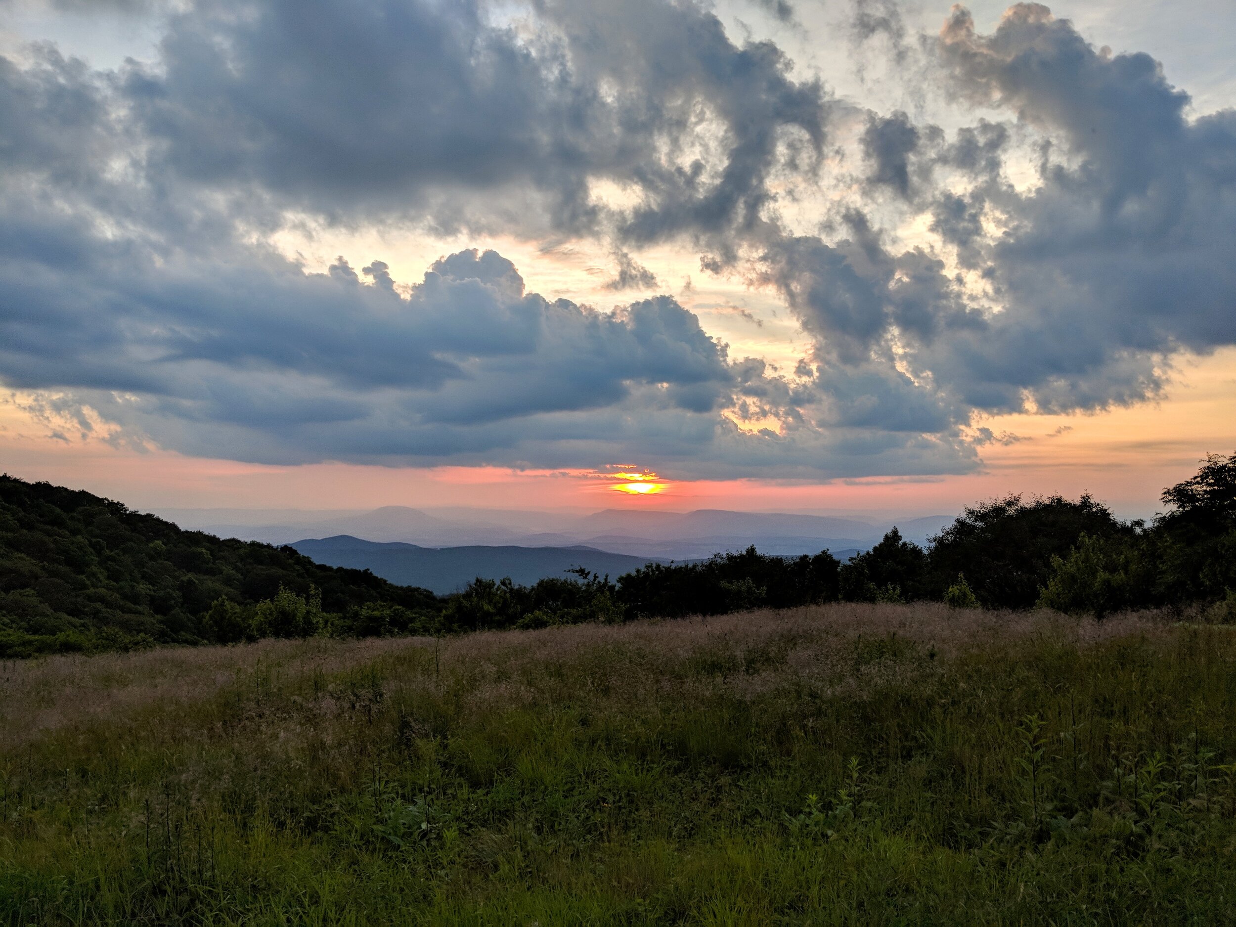
The bugs are atrocious and it’s hot, but the sweaty climb up to Bald Knob passes quickly. Bald Knob is not bald at all, but later, the ridge opens up to a wide grassy summit on Cole Mountain. It’s sunset, and the views are beautiful, and we stay as long as we can stand the mosquitoes and biting gnats. Then it’s a short mile through the darkening woods to a meadow at Hog Camp Gap with beautiful campsites. My phone musters the service to connect for a brief Father’s Day chat with my dad before dropping the call. Bold mice dart for our food bags as we sit in a circle and eat a hasty dinner by the light of our headlamps. We throw meticulous PCT-hangs to hopefully keep the critters out of our provisions, and then we go to sleep.