
Days 67-70: Central Virginia Views and Brews
June 18th. Day 67: Hog Camp Gap to the Tye River suspension bridge — 19.1 miles
In the middle of June, we enjoy a brief break from the daily rainstorms, but the bugs arrive in force. Some days, like today, you can’t stop moving without being devoured. We hike fast, with few breaks. When we pause for lunch, we throw together our meals and then eat them while pacing in circles, swatting with one hand and shoveling food with the other. During the day, it’s small biting gnats with an affinity for human eyeballs. In the evening, it’s mosquitoes.

Tadpoles!
Today, the trail mostly follows a ridge, and later we will finish the day with a 3,000 foot descent to the Tye River. At Spy Rock, we scramble up to a broad, rocky outcropping where the exposure to the bright sun and high winds provides sudden relief from the swarms of gnats. I sprawl on the warm stone, deeply thankful for the chance to just be still. We snack and linger, watching hundreds of tadpoles floundering in shrinking puddles. We use our trekking poles to guide the little creatures to the deepest part of the puddles, and I find myself hoping on their behalf that the rain returns soon.
That afternoon, we arrive at the Priest shelter, which is famous for its hiker log. Instead of the usual notes about mileage and weather, here it’s tradition to confess your trail sins. I flip through the notebook, equal parts amused and alarmed. “Forgive me Father, for I have sinned,” begins each entry. Some confessions are goofy, some are sexually explicit, and some are downright disturbing. I want to read more, but I’m accumulating mosquito bites by the minute, so I stop after skimming a couple of pages, scrawl a couple transgressions of my own, and then get moving. The descent from the Priest is a series of switchbacks, so the terrain is smooth but unrelenting. Toward the bottom, I am leaning heavily on my trekking poles. My right knee aches with every step. I do my best to ignore it. I’m getting stronger every day, I tell myself. This pain will go away.
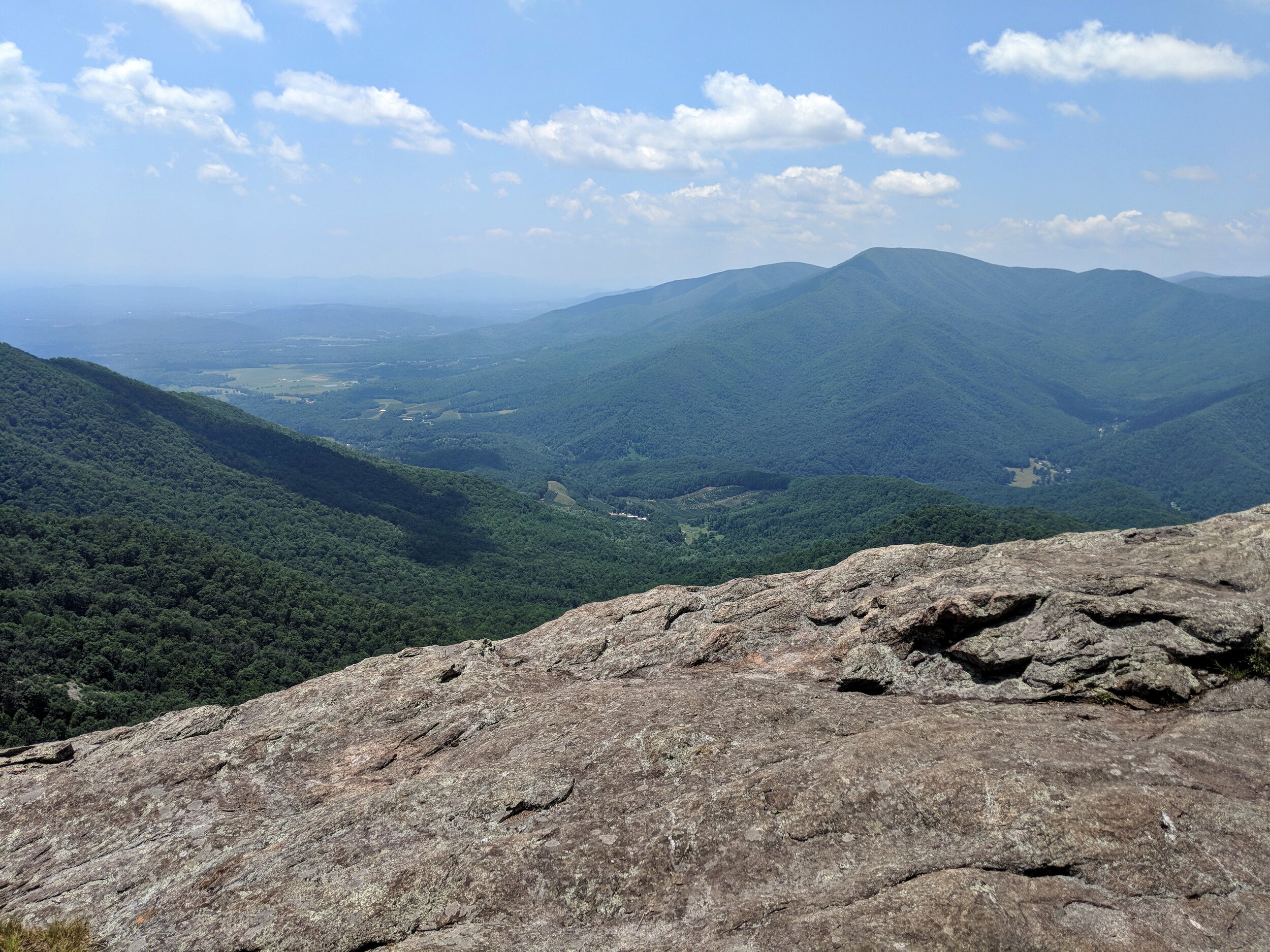
Views in the Three Ridges Wilderness
June 19th. Day 68: Tye River to Reed’s Gap/Devil’s Backbone Brewery — 10.7 miles
The next morning, we hike ten miles to Reed’s Gap, where we wait for my sister to pick us up and drive us to the nearby Devil’s Backbone Brewery. Aleyna is a music student at Florida State, but she is home in Virginia for summer break. Her boyfriend is visiting, and they have decided to drive up to meet us here in Lexington on the way to our brother’s house in Harrisonburg. Aleyna and Garrison arrive, and we squeeze unceremoniously into her car.
Devil’s Backbone Brewery is one of the most hiker-friendly businesses along the trail. They offer camping and a shuttle, and the hikers return the favor by buying copious amounts of food and beer. We share a large meal with Aleyna and Garrison, then head over to the grassy camping area. At dusk, fireflies appear, hundreds of them floating above the grass. We catch dozens of them in a Talenti ice cream jar until we get tired of watching their synchronized glow, and we set them all free again.
June 20th. Day 69: Reed’s Gap to Rockfish Gap — 19.1 miles
For a small fee, Devil’s Backbone offers a beautiful breakfast to hikers before the shuttle back to the trail. We eat and help ourselves to various DBB swag— Appalachian Trail t-shirts, DBB bumper stickers, bandannas, and more. With his black and white bandanna and his scruffy beard, Etienne looks like a pirate, so I offer him the foam sword that I’ve been wielding since Trail Days to complete the new persona.
We manage to fit 13 hikers and backpacks into a single pickup truck for the shuttle back to the tail, and then we cruise through the forest, hoping to beat the coming thunderstorms. It’s been a nice four days without rain, but this is the Appalachian Trail. Precipitation is never gone for long.
Late afternoon, we arrive at Rockfish Gap, where most hikers hitch into Waynesboro before starting the much-anticipated hike through Shenandoah National Park. On my section hike in 2016, I stayed at Stanimal’s hostel in Waynesboro. Now, however, my older brother arrives to bring us home for two nights of rest. We load our packs into the bed of the truck and climb in for a ride, “fresh” in our matching brewery t-shirts but still smelly enough that Derek rolls down the windows.
Halfway through the 45-minute drive to his house, the sky opens and the rain falls in sheets. Derek pulls over so that Rob can rescue his camera from his pack in the bed of the truck. When we arrive, Derek and his wife Emma feed us several pizzas, and we eat every bite.
June 21st. Day 70: Derek and Emma’s house— 0 miles

Mia!
We spend a restful zero day at Derek and Emma’s house, while outside the rain pours and pours, causing major flooding in surrounding areas. We are thankful not to be hiking today. This has been one of the wettest years on record in the southeast, and out on the Appalachian Trail, we have felt it. But today, indoors, we watch TV, play with my niece-dog Mia, and resupply at Walmart. It’s good to give our bodies a day to refresh, because we plan to average 18 miles per day for the next nine days in order to reach Harper’s Ferry by our self-imposed deadline of July 1st. Tomorrow we tackle a twenty-mile day in Shenandoah National Park, known for its gentle trails, blackberry milkshakes, and the best chance for bear sightings on the Appalachian Trail.


